-
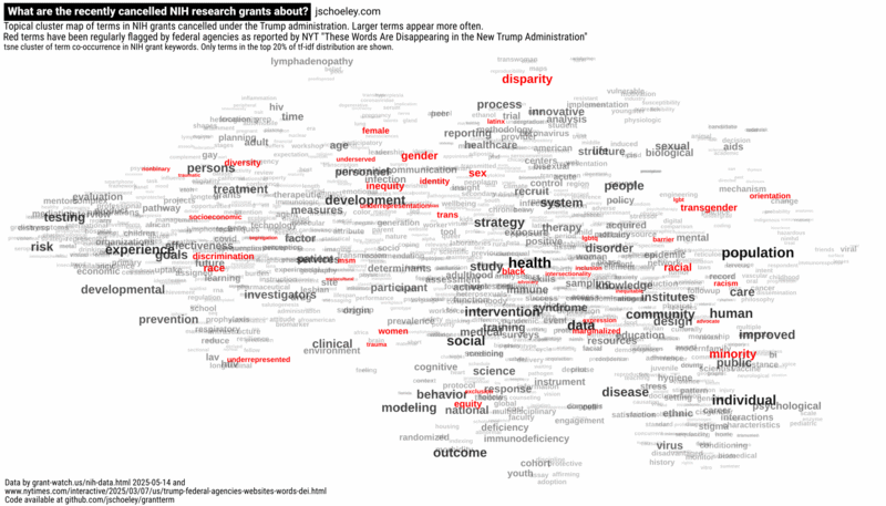
What are the recently cancelled NIH research grants about?
-
But Why? Design choices made while creating "Regional population structures at a glance"
An earlier version of this article has been published in Schöley, J. & Kashnitsky, I. But Why? Design choices made while creating “Regional population structures at a glance”. New Generations in Demography, Oeconomica Publishing House, 2019.
-
Creating equal-area grids
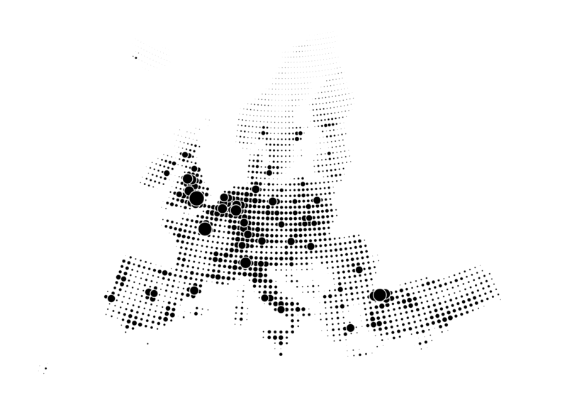
A while ago I published a bubble-grid map of the European continent showing absolute population change over a regular grid. But I made a rookie mistake: I’ve accidentally created a grid where the grid cells have different areas, thereby compromising the bubble grid map which is supposed to show counts over equal areas. This mistake happened because I created the grid over geographic data in spherical coordinates (latitude-longitude data). What I should have done (and correctly did in a subsequent blog post) is to project the geodata to equal-area coordinates before applying a grid. Here’s a demonstration of the wrong and the correct approach…
-
Bubble-grid versus choropleth maps

-
Bubble-grid-maps